 PPT Slide |
 About this tutorial |
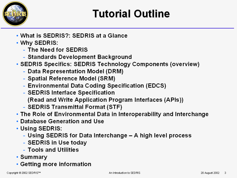 Tutorial Outline |
 PPT Slide |
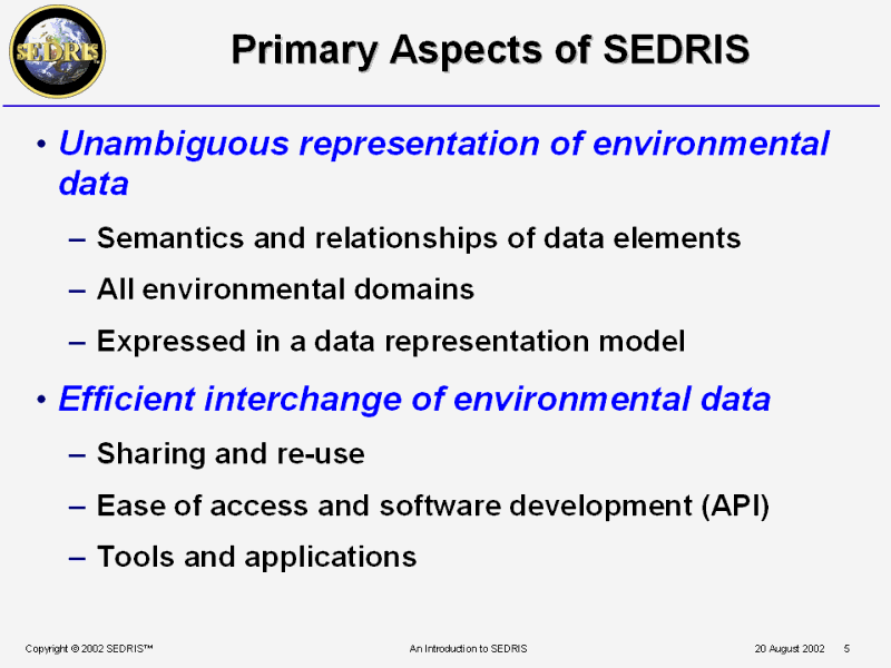 Primary Aspects of SEDRIS |
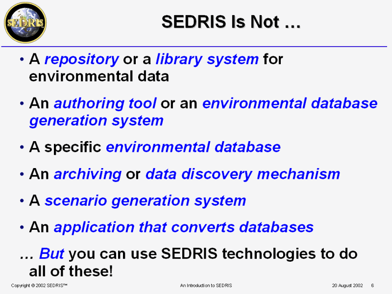 SEDRIS Is Not � |
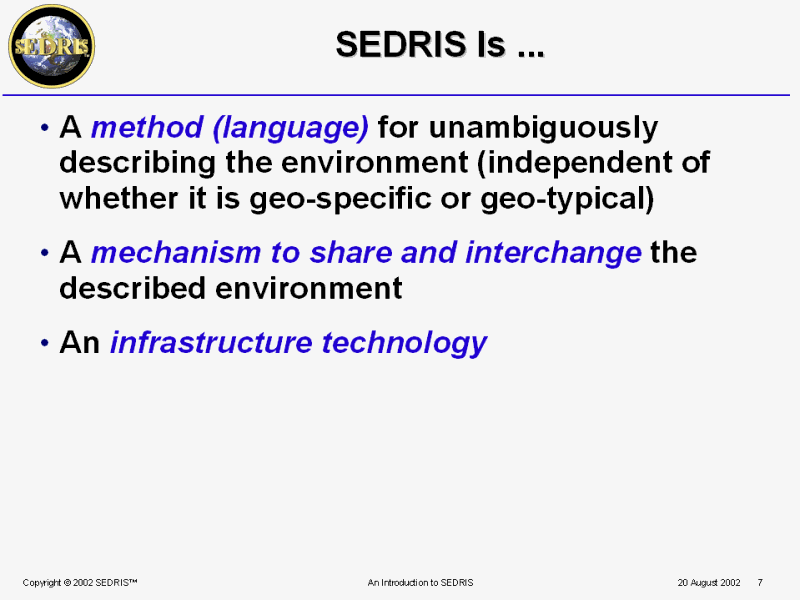 SEDRIS Is ... |
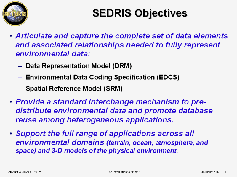 SEDRIS Objectives |
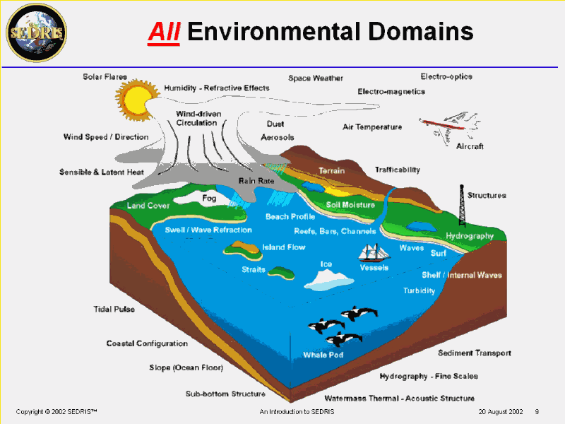 All Environmental Domains |
 An Integrated Model of the Environment |
 PPT Slide |
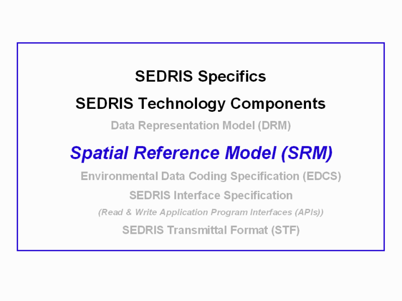
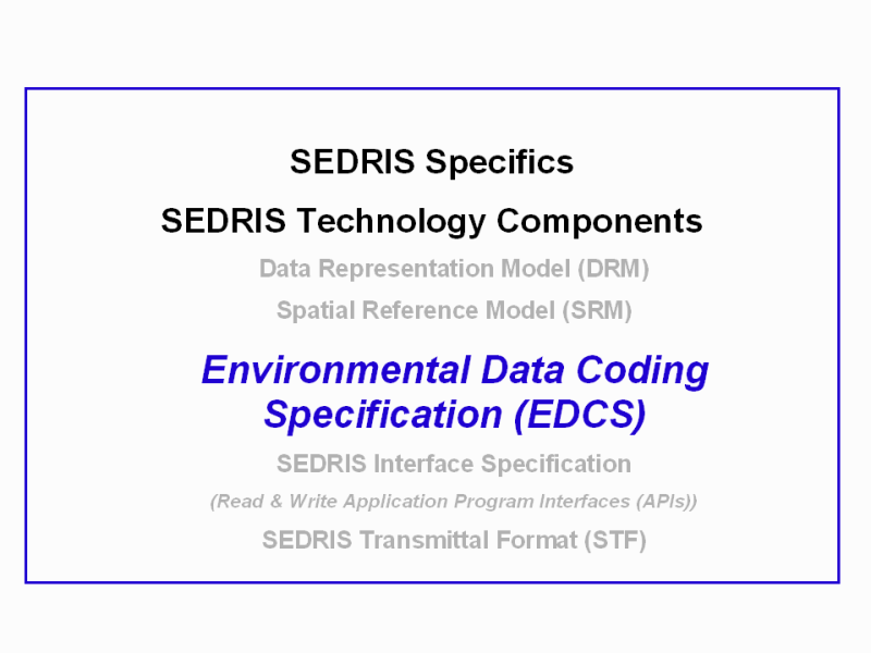
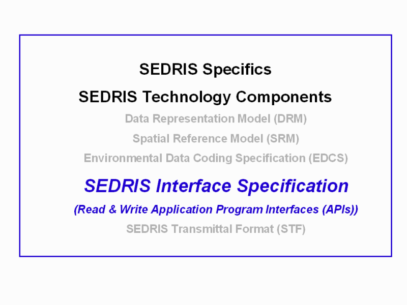
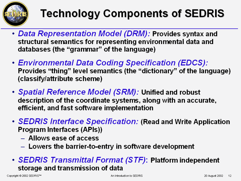 Technology Components of SEDRIS |
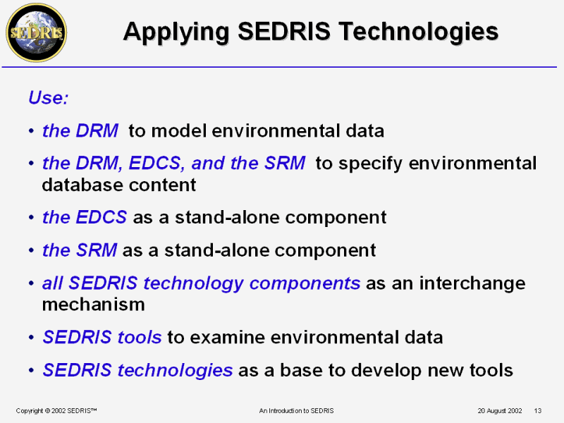 Applying SEDRIS Technologies |
 PPT Slide |
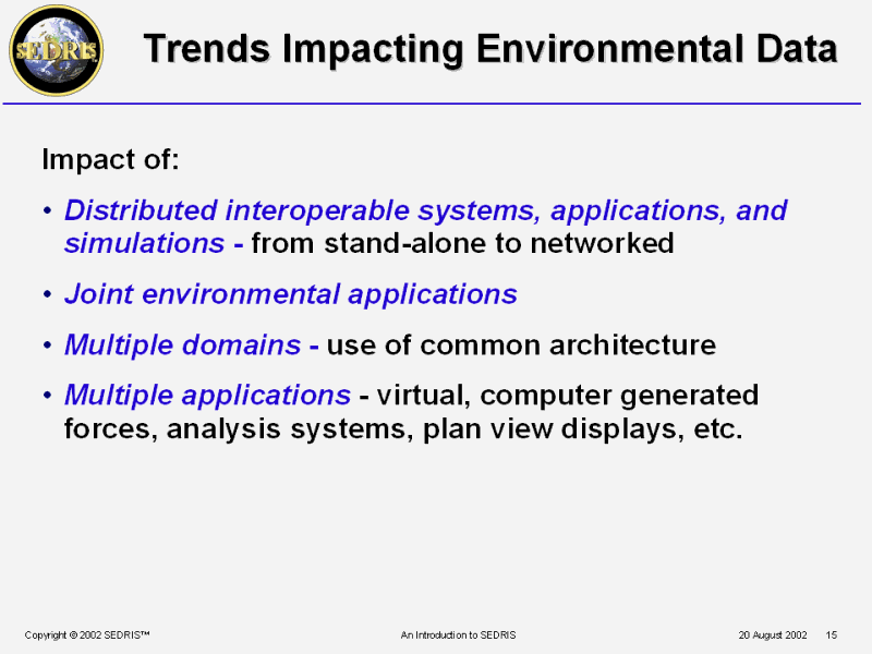 Trends Impacting Environmental Data |
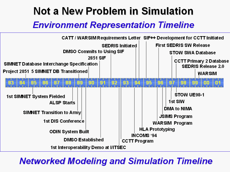 Environment Representation Timeline |
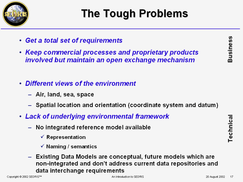 The Tough Problems |
 Commercial Process Issues |
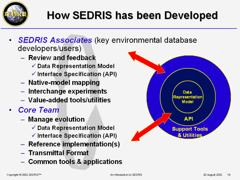 How SEDRIS has been Developed |
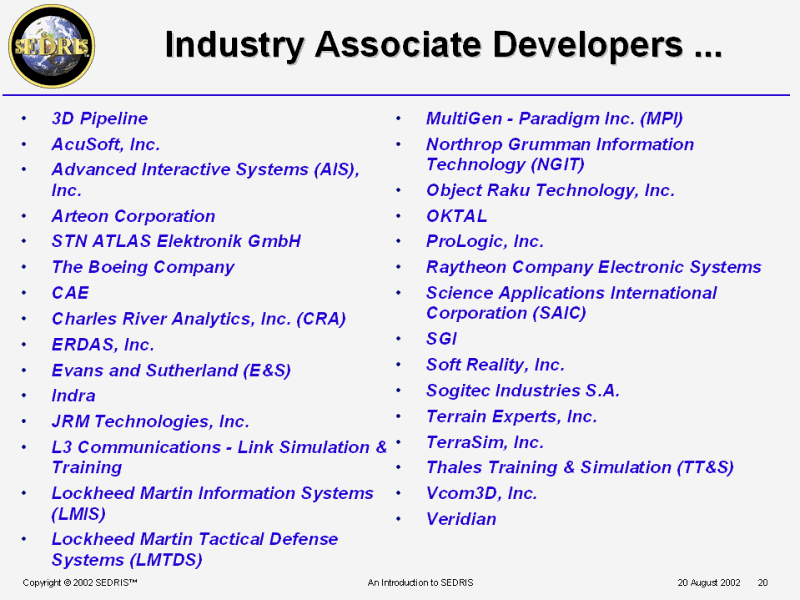 Industry Associate Developers ... |
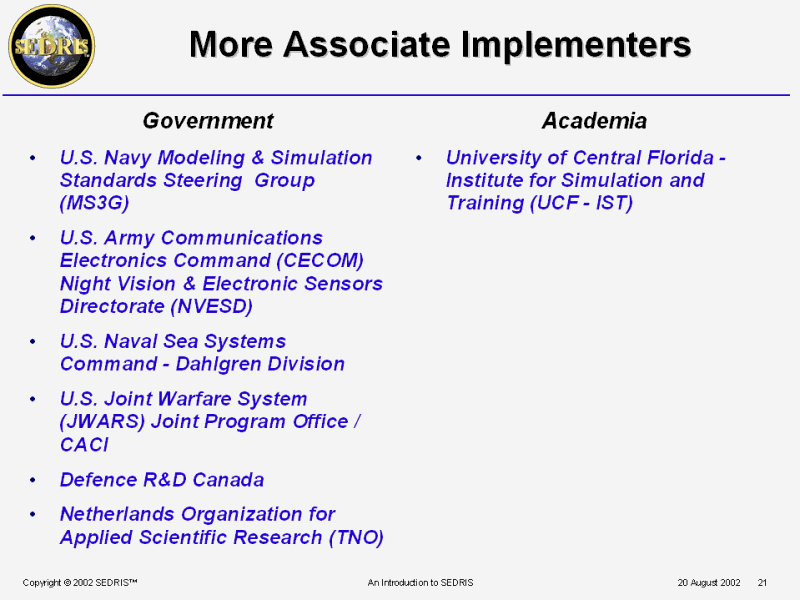 More Associate Implementers |
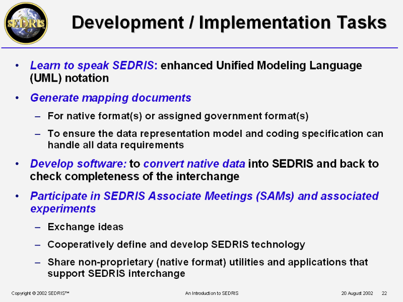 Development / Implementation Tasks |
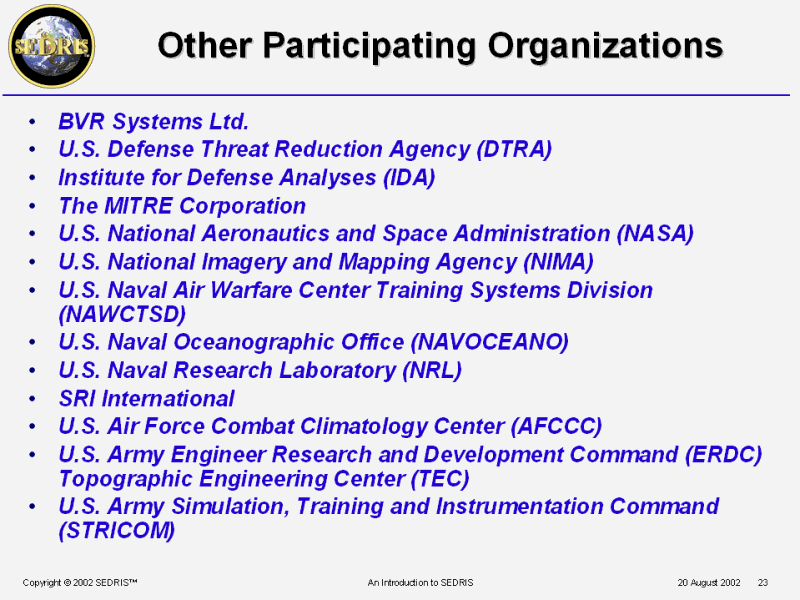 Other Participating Organizations |
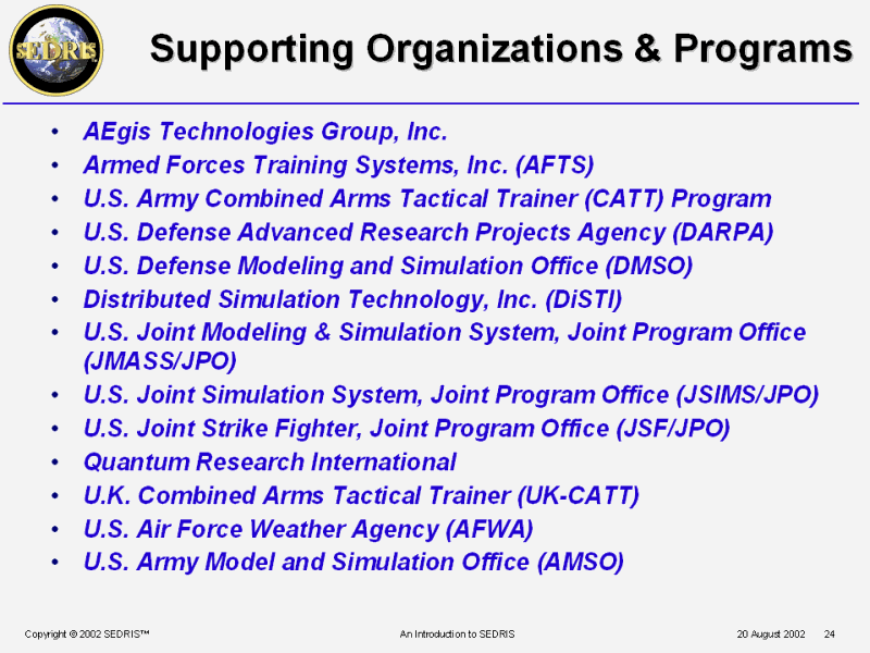 Supporting Organizations & Programs |
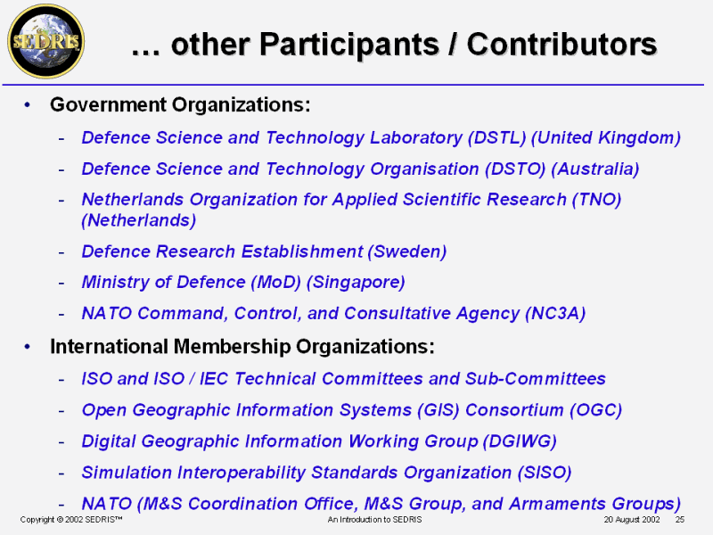 � other Participants / Contributors |
 PPT Slide |
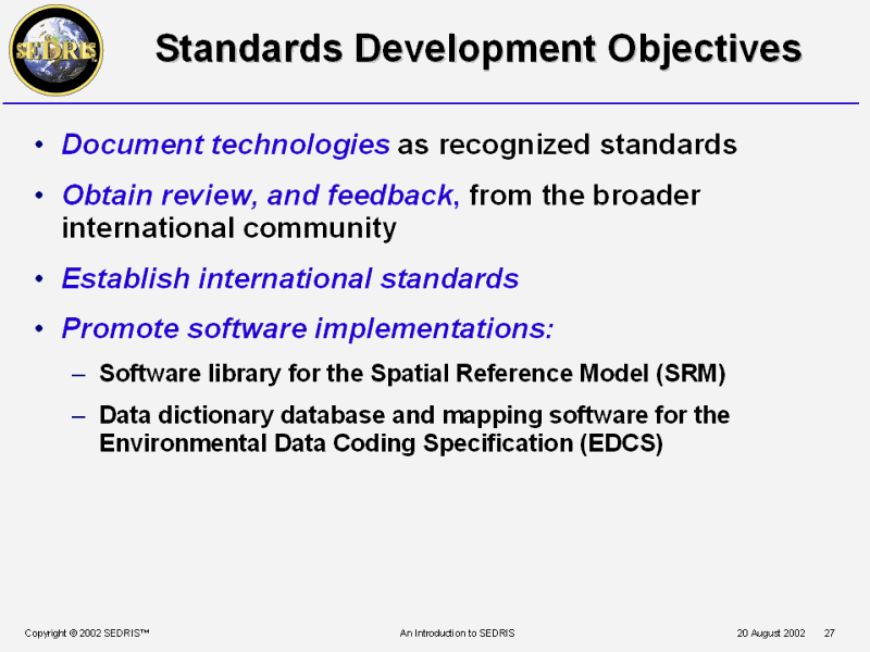 Standards Development Objectives |
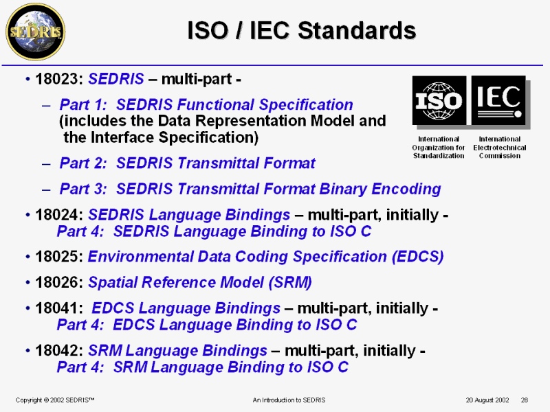 ISO / IEC Standards |
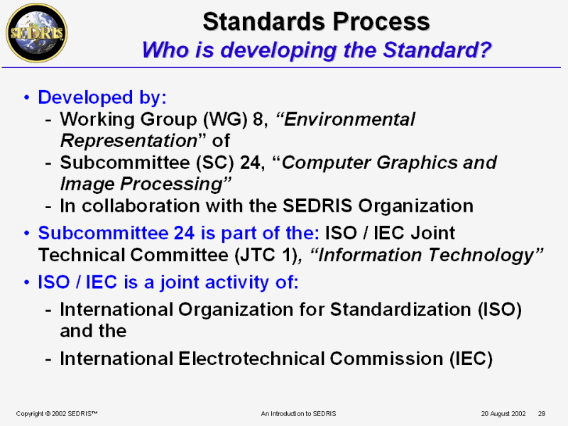 Standards Process Who is developing the Standard? |
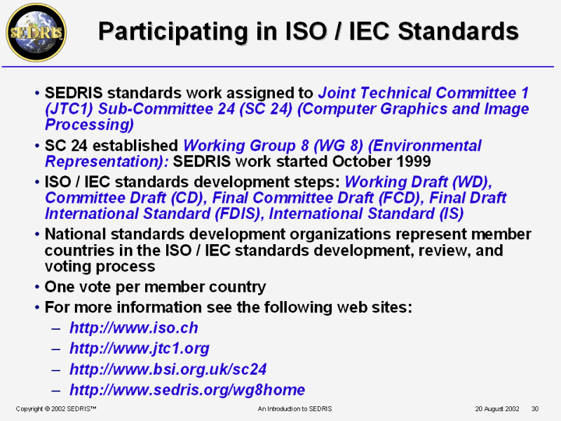 Participating in ISO / IEC Standards |
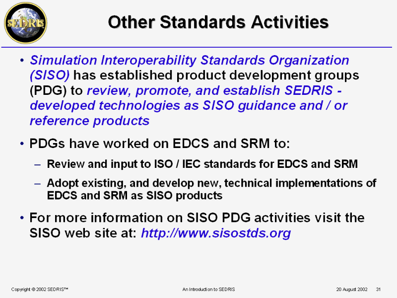 Other Standards Activities |
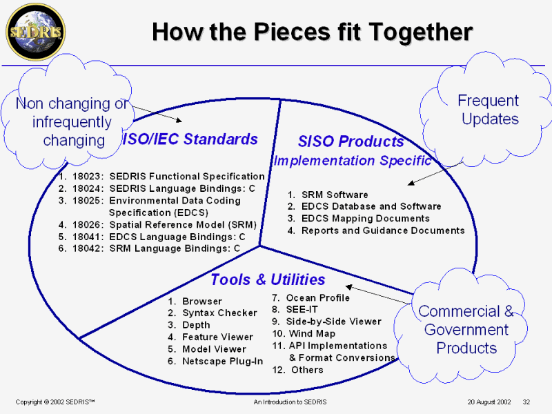 How the Pieces fit Together |
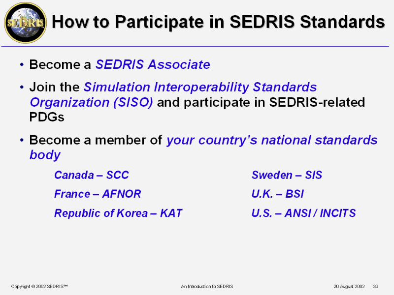 How to Participate in SEDRIS Standards |
 PPT Slide |
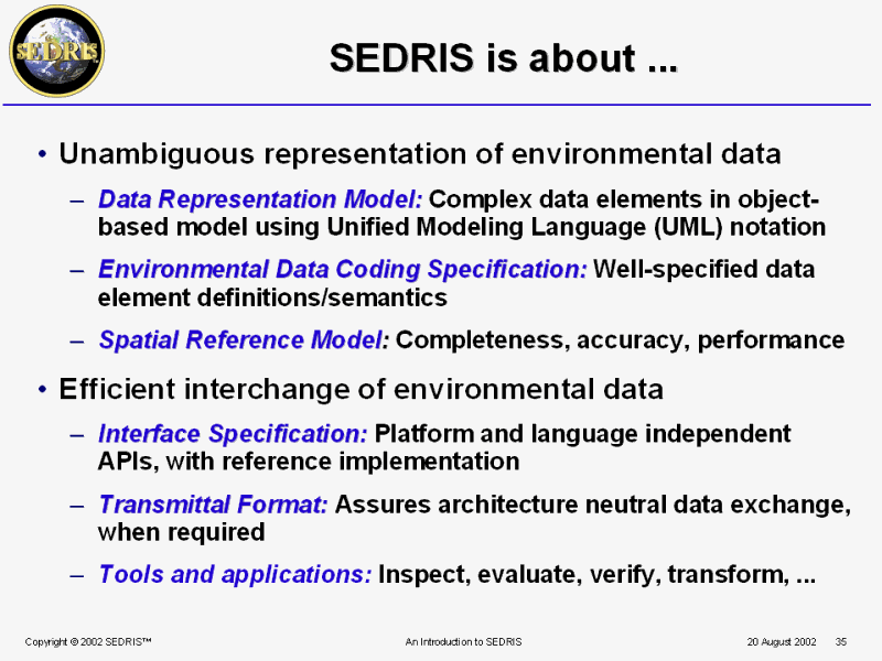 SEDRIS is about ... |
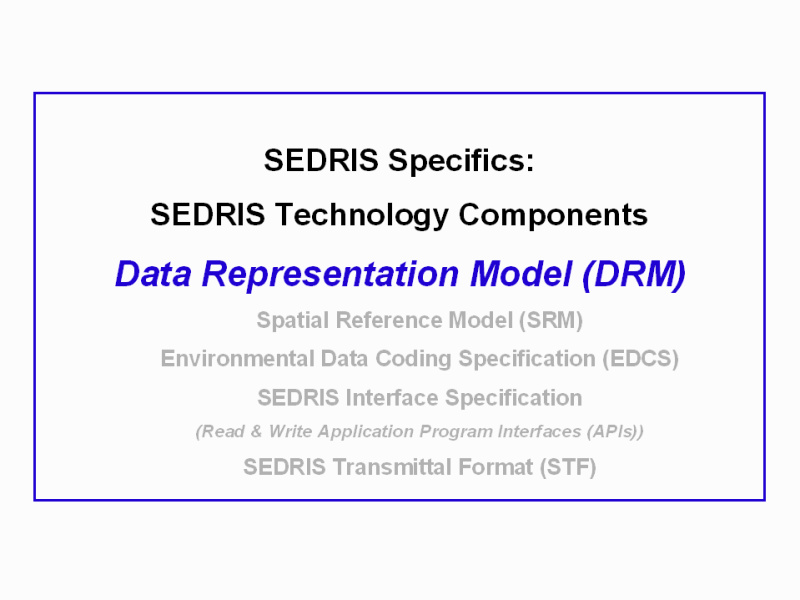
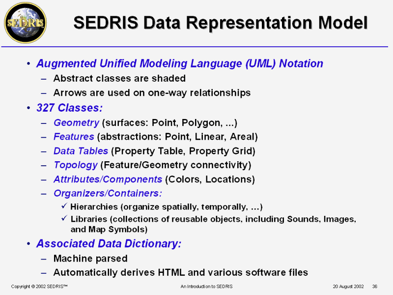 SEDRIS Data Representation Model |
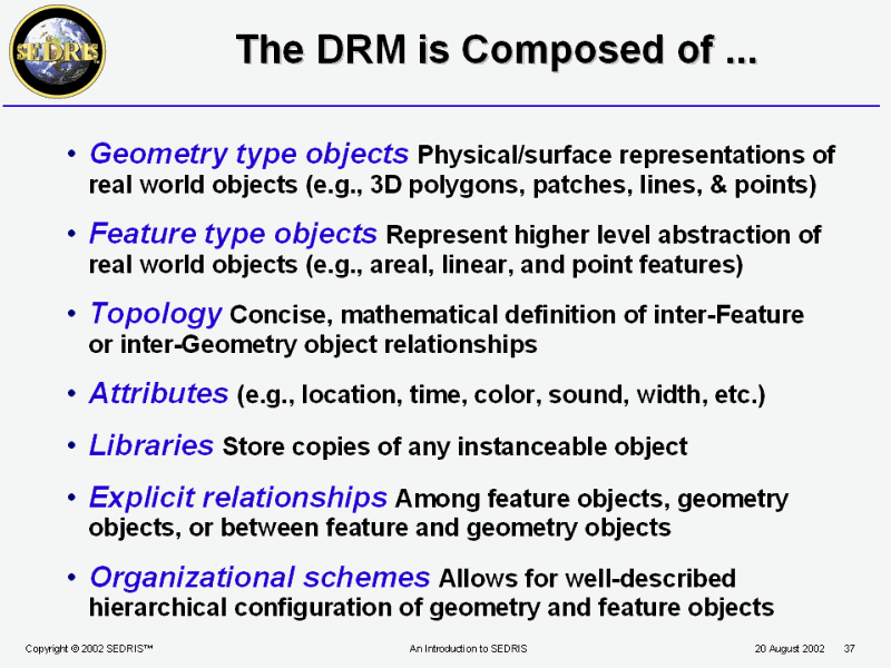 The DRM is Composed of ... |
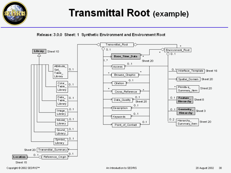 Transmittal Root (example) |
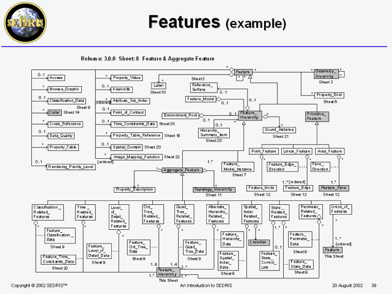 Features (example) |
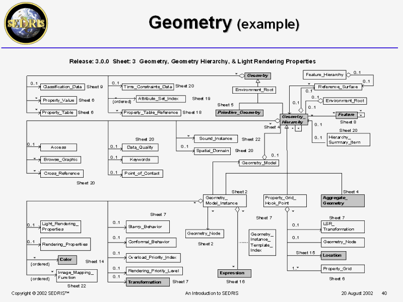 Geometry (example) |
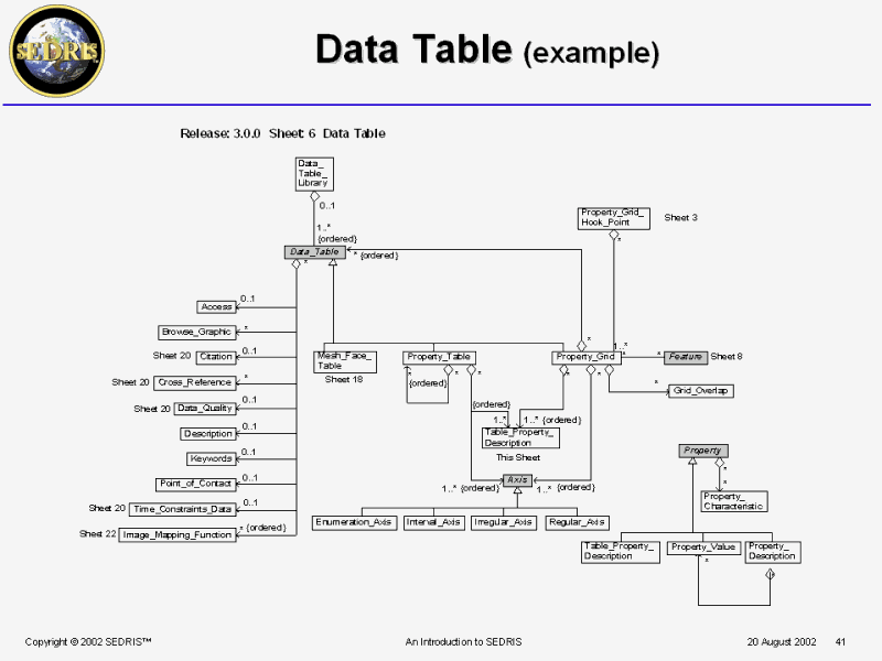 Data Table (example) |
 DRM Tutorial |
 PPT Slide |
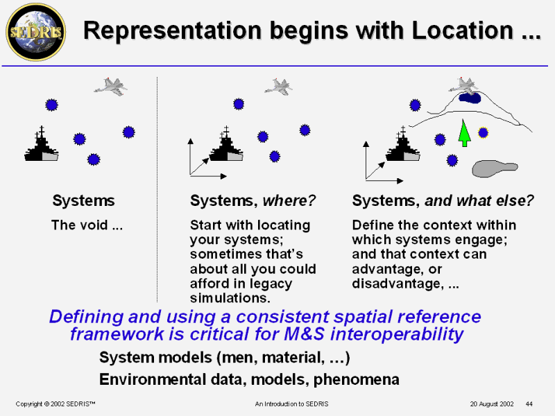 Representation begins with Location ... |
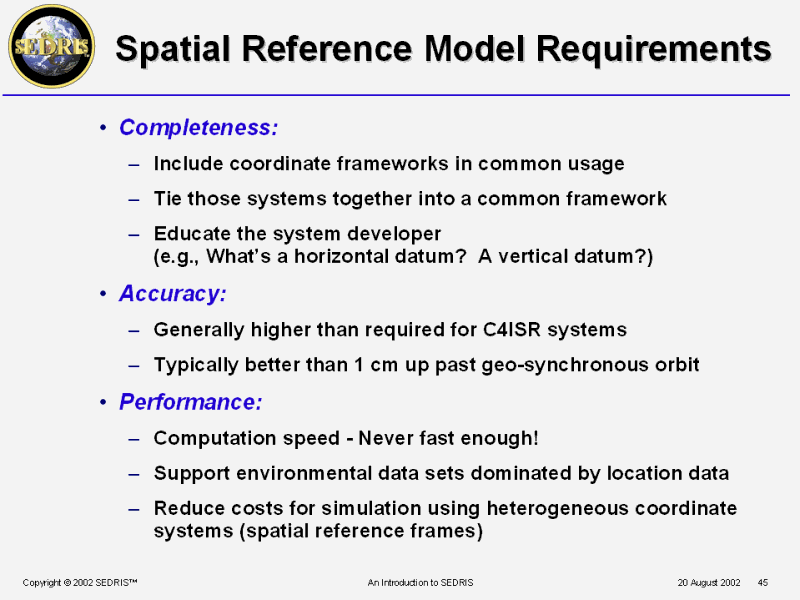 Spatial Reference Model Requirements |
 Spatial Reference Frames |
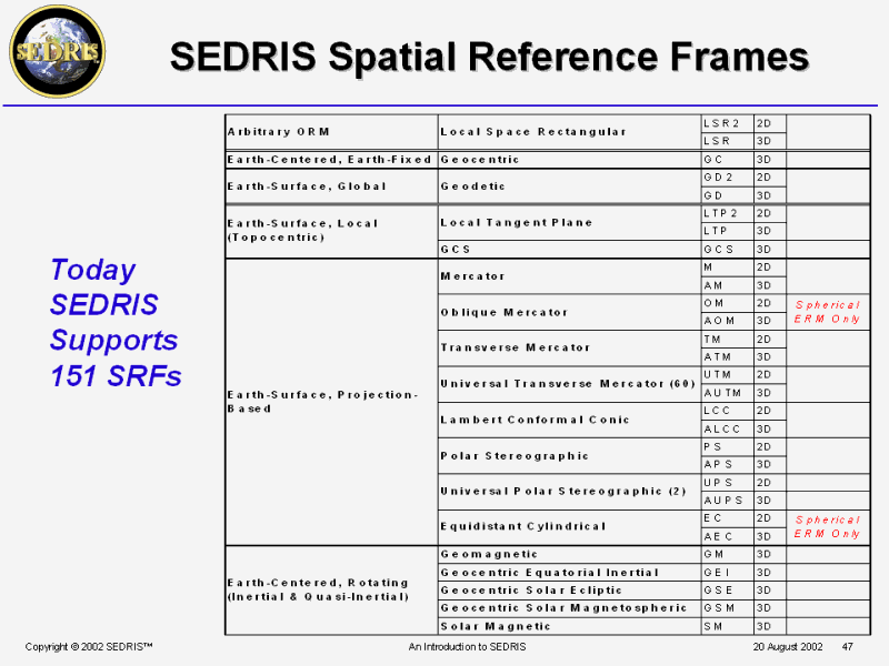 SEDRIS Spatial Reference Frames |
 SRM Tutorial |
 PPT Slide |
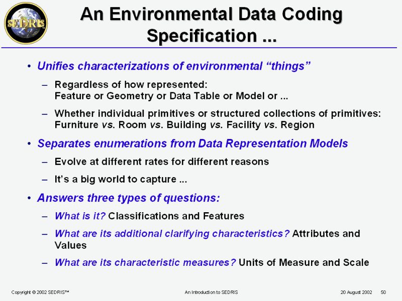 An Environmental Data Coding Specification ... |
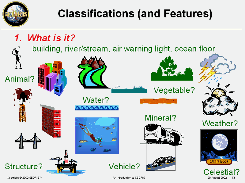 Classifications (and Features) |
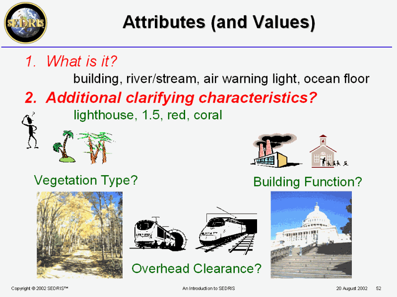 Attributes (and Values) |
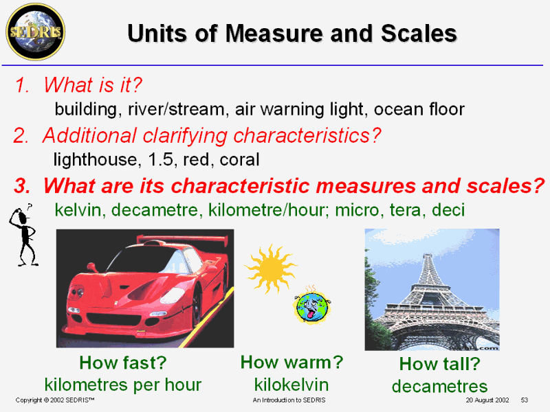 Units of Measure and Scales |
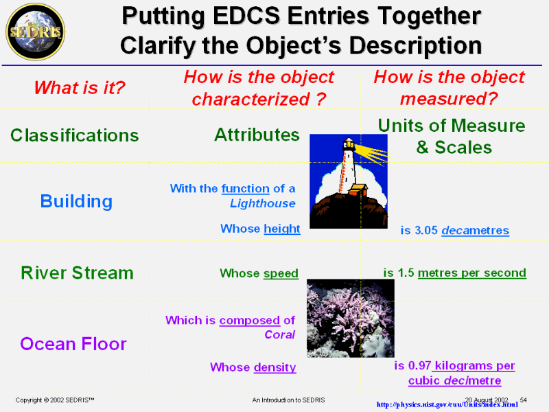 Putting EDCS Entries Together Clarify the Object�s Description |
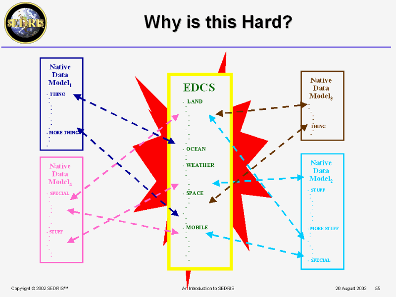 Why is this Hard? |
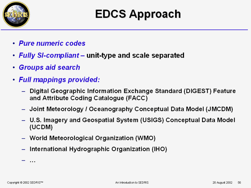 EDCS Approach |
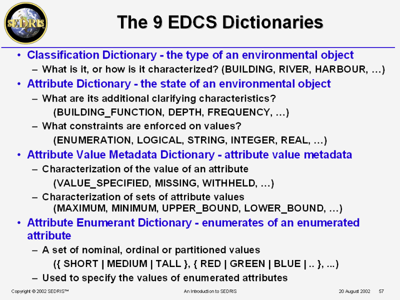 The 9 EDCS Dictionaries |
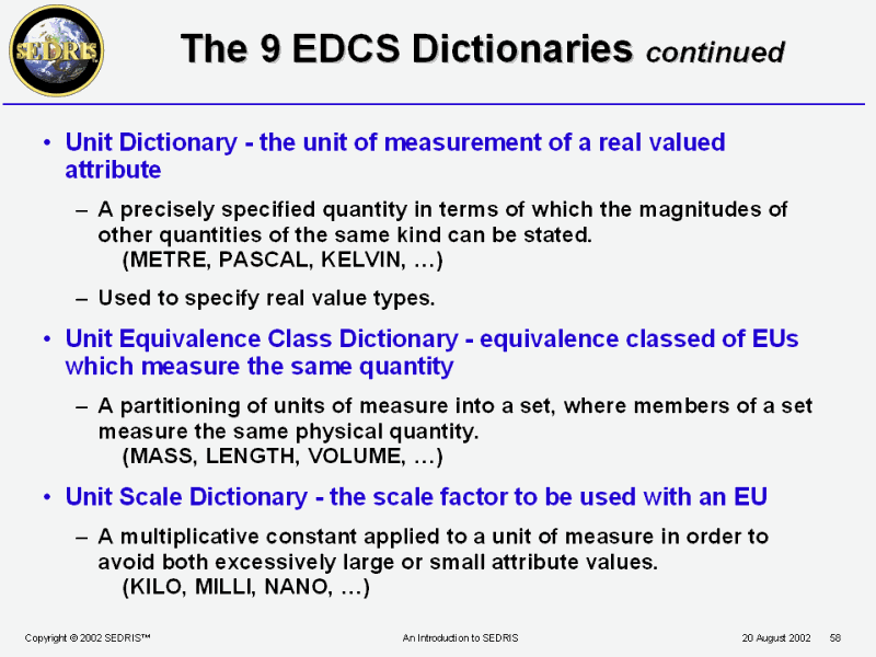 The 9 EDCS Dictionaries continued |
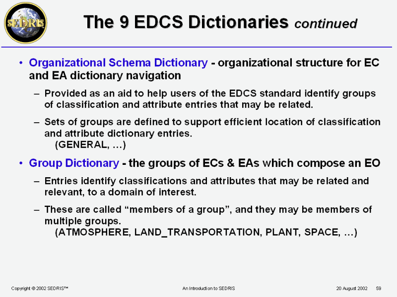 The 9 EDCS Dictionaries continued |
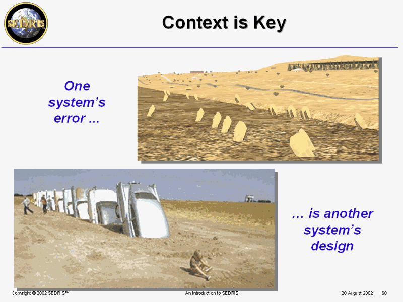 Context is Key |
 EDCS Tutorial |
 PPT Slide |
 Definitions |
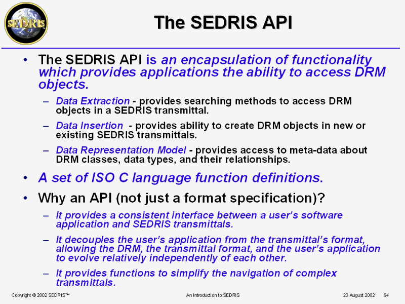 The SEDRIS API |
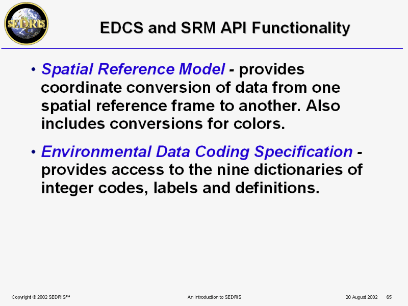 EDCS and SRM API Functionality |
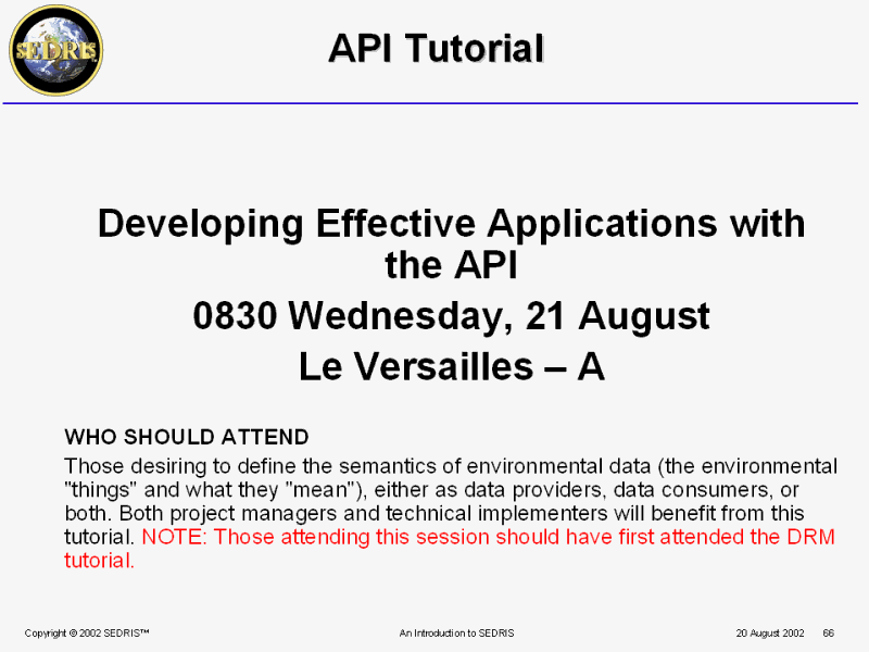 API Tutorial |
 PPT Slide |
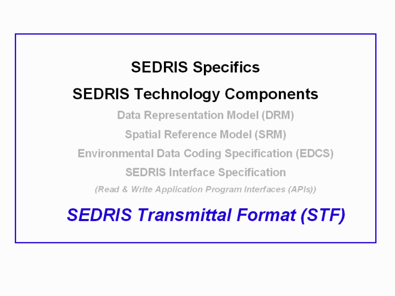
 SEDRIS Transmittal Format (STF) |
 Transmittal Format - Requirements |
 STF Design Features |
 PPT Slide |
 Applications Using Environmental Data |
 Why do we Model or Simulate? |
 Is Realness a Big Factor? |
 Consistent Representation of Reality? |
 Why the Need for Interoperability? |
 Interchange vs. Interoperability |
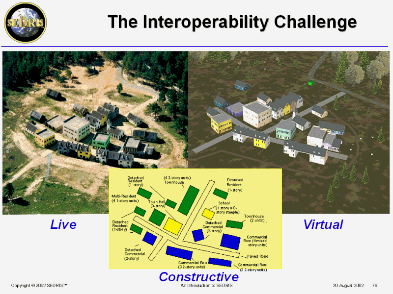 The Interoperability Challenge |
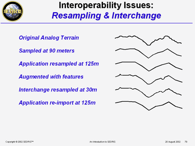 Interoperability Issues: Resampling & Interchange |
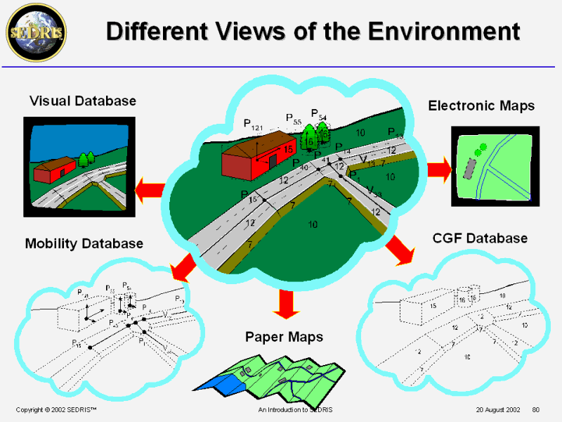 Different Views of the Environment |
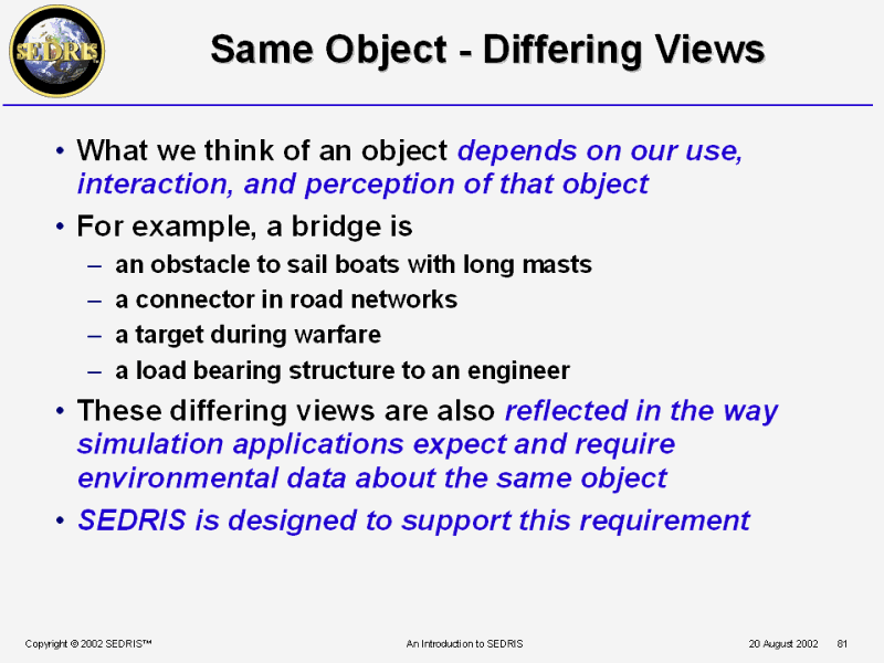 Same Object - Differing Views |
 Six Interoperabilities of Data |
 Six Data Interoperabilities & SEDRIS |
 Interoperability & Interchange |
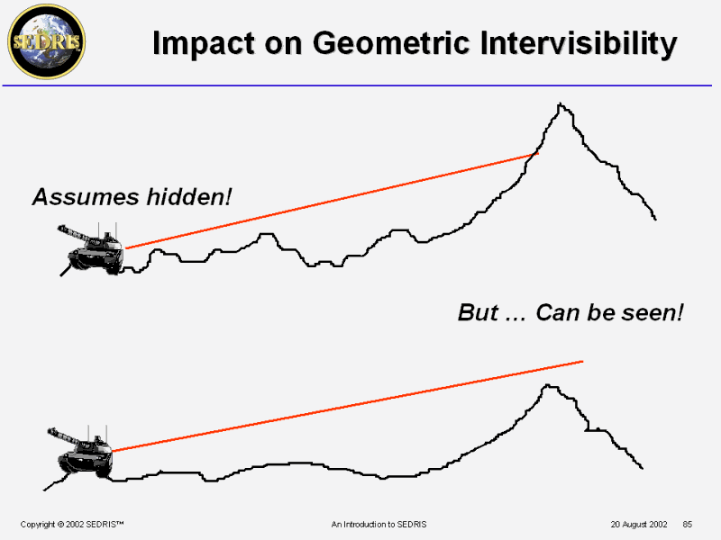 Impact on Geometric Intervisibility |
 PPT Slide |
 What Constitutes a Database? |
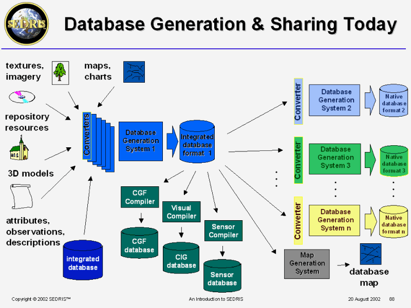 Database Generation & Sharing Today |
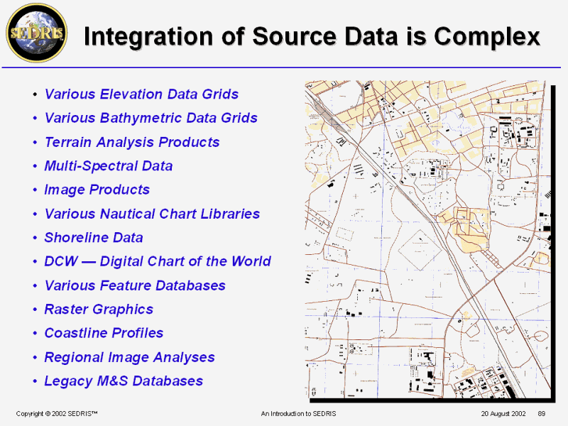 Integration of Source Data is Complex |
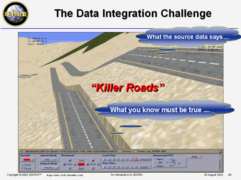 The Data Integration Challenge |
 PPT Slide |
 PPT Slide |
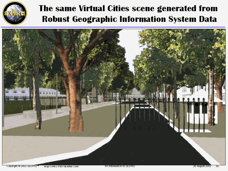
 PPT Slide |
 PPT Slide |
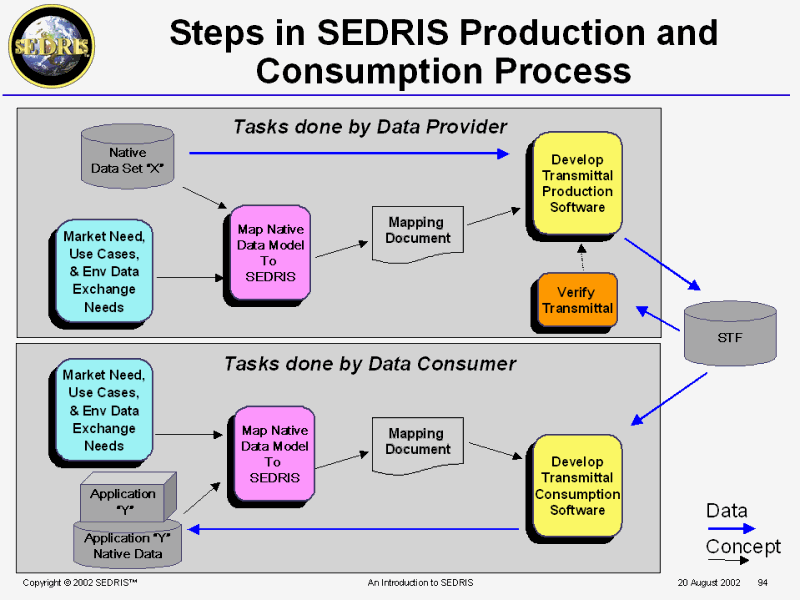
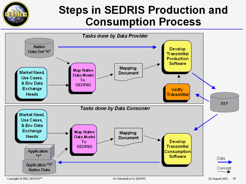
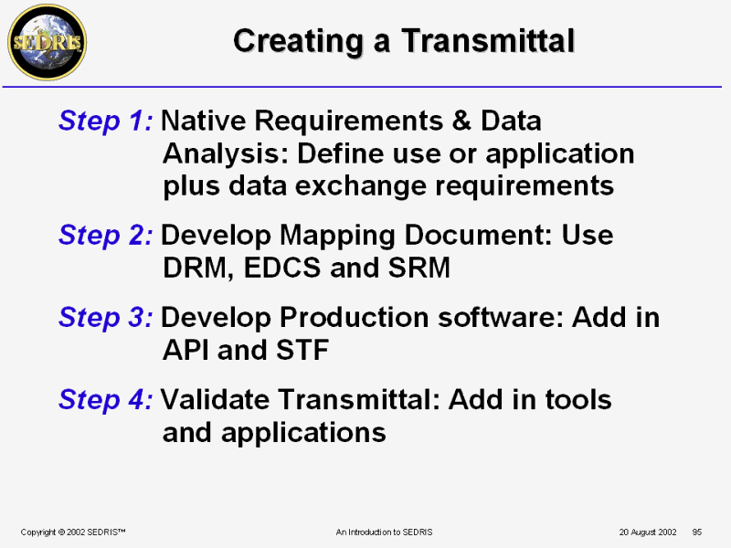 Creating a Transmittal |
 Documentation |
 PPT Slide |
 Consuming SEDRIS Transmittals |
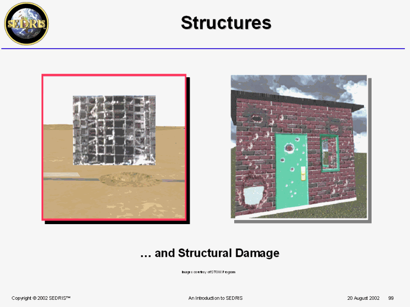 Structures |
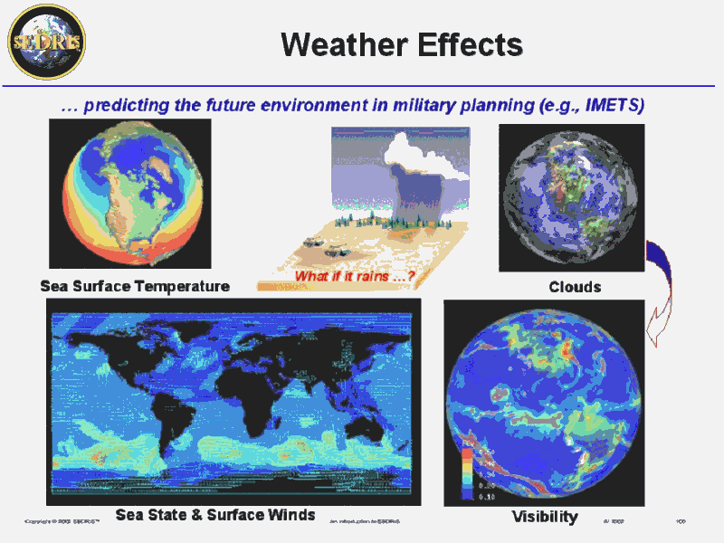 Weather Effects |
 Characteristics of METOC Data |
 Atmosphere-Ocean Variables ... |
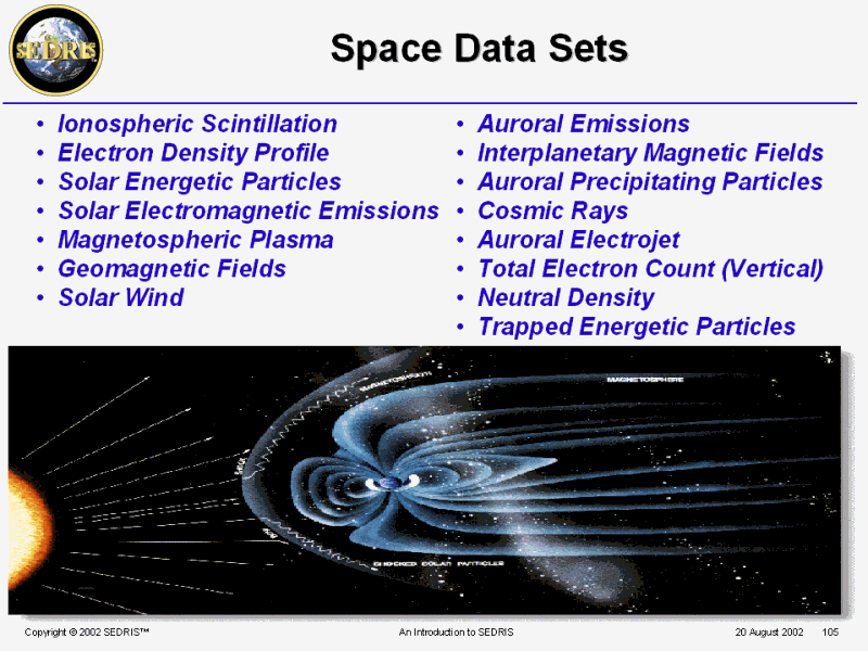
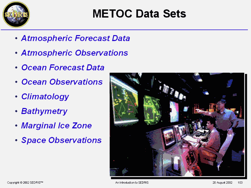 METOC Data Sets |
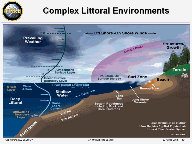 Complex Littoral Environments |
 PPT Slide |
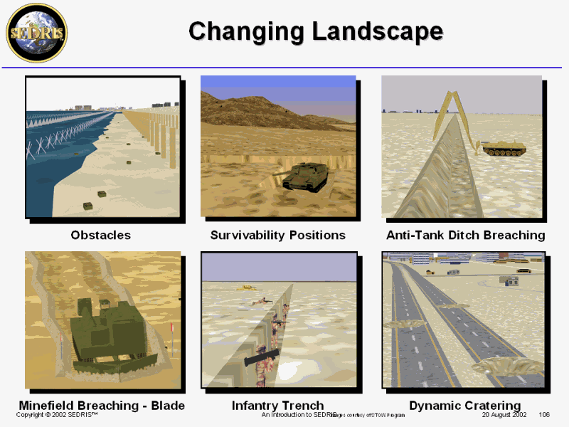 Changing Landscape |
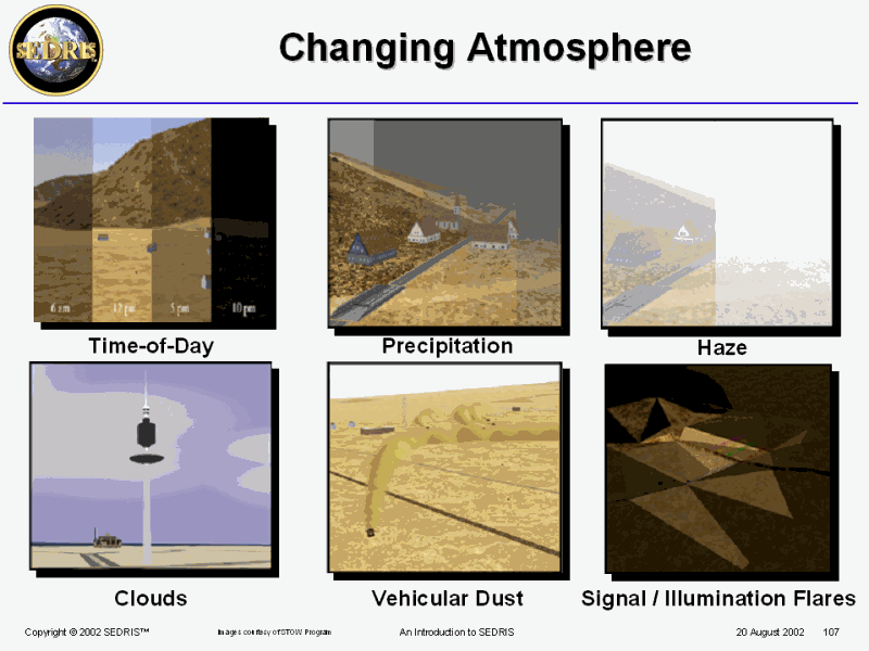 Changing Atmosphere |
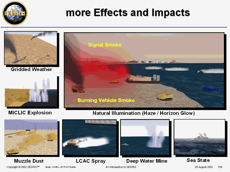 more Effects and Impacts |
 Support for Computer Generated Forces |
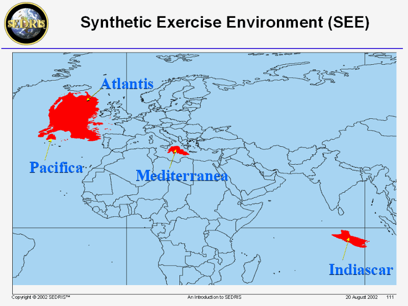
 Geo-Typical Environments |
 PPT Slide |
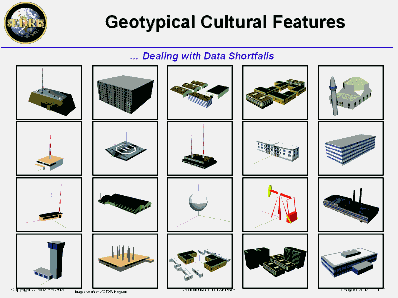 Geotypical Cultural Features |
 Critical Areas: Database Generation |
 Some Key Things to Remember |
 PPT Slide |
 PPT Slide |
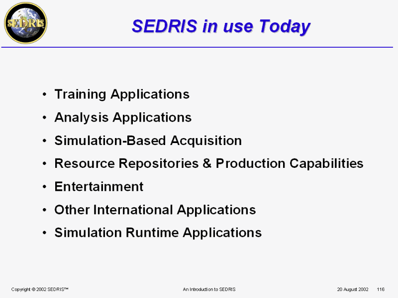
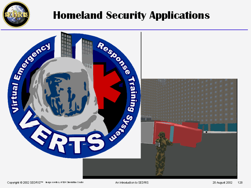
 SEDRIS in use Today Training Applications |
 PPT Slide |
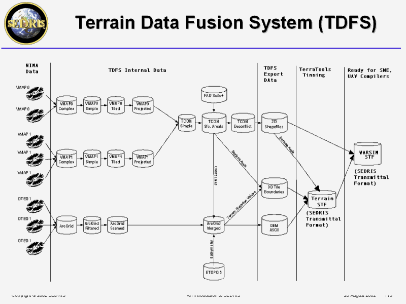 Terrain Data Fusion System (TDFS) |
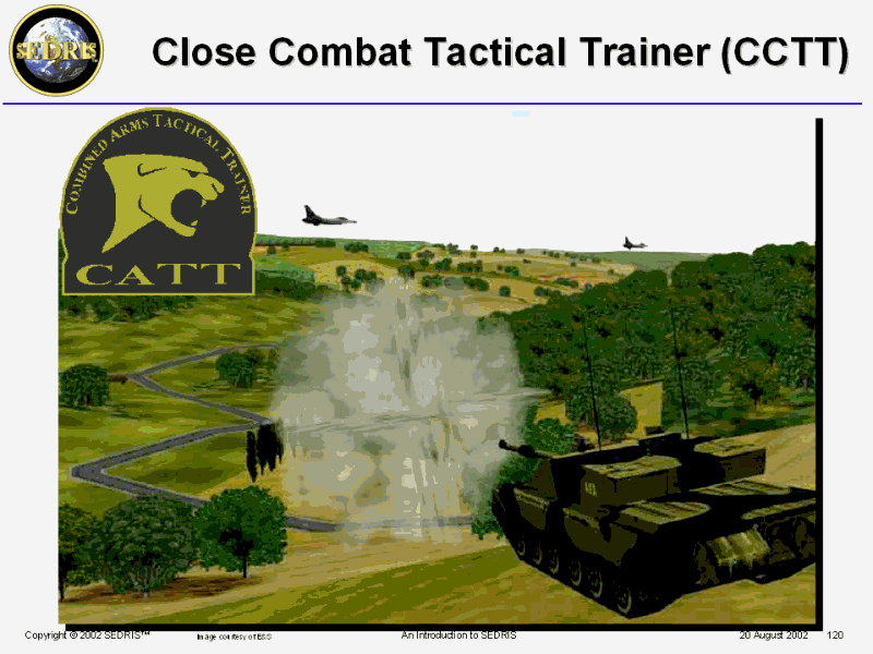 Close Combat Tactical Trainer (CCTT) |
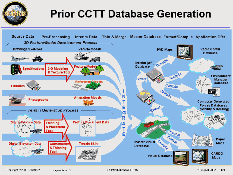 Prior CCTT Database Generation |
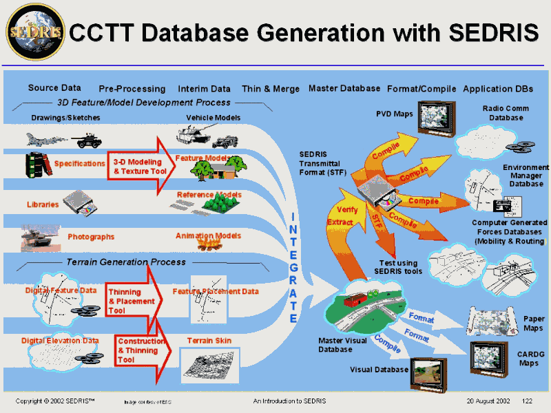 CCTT Database Generation with SEDRIS |
 PPT Slide |
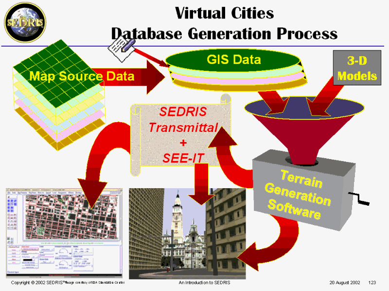
 PPT Slide |
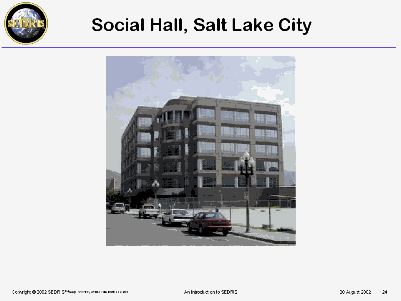
 PPT Slide |
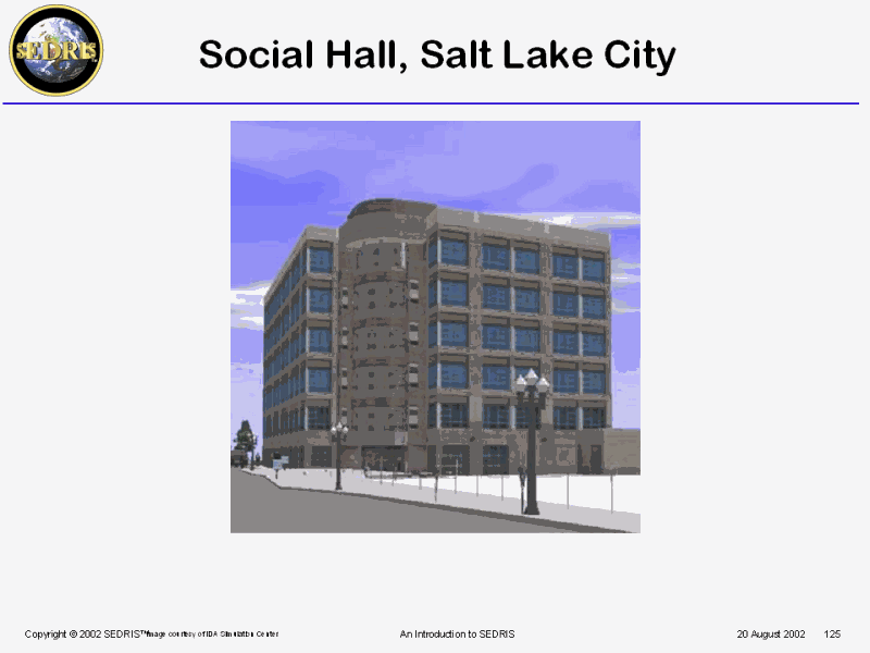
 PPT Slide |
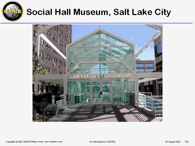
 PPT Slide |
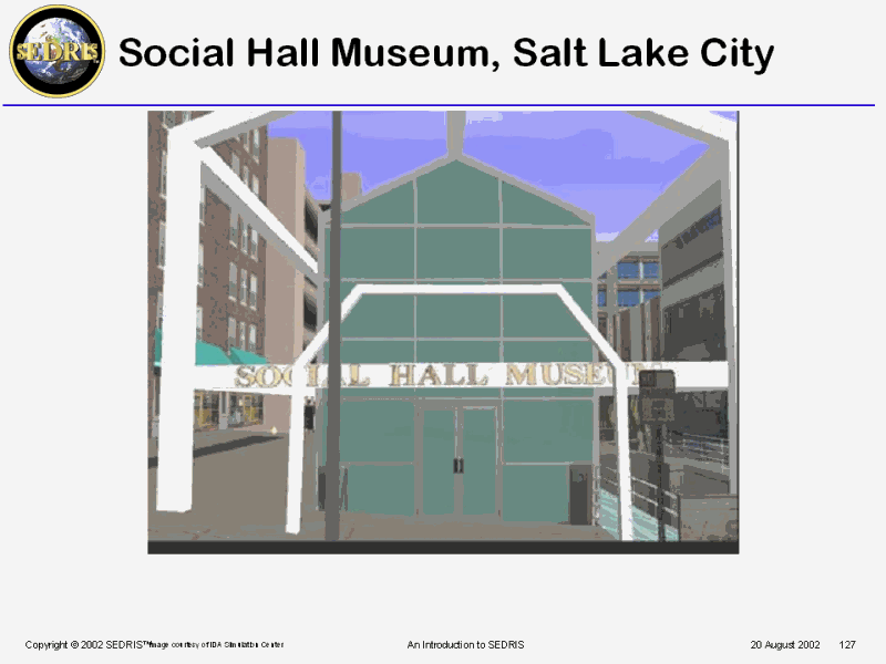
 PPT Slide |
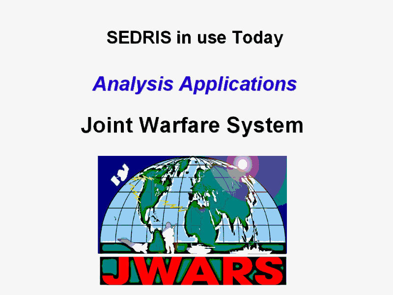 SEDRIS in use Today Analysis Applications |
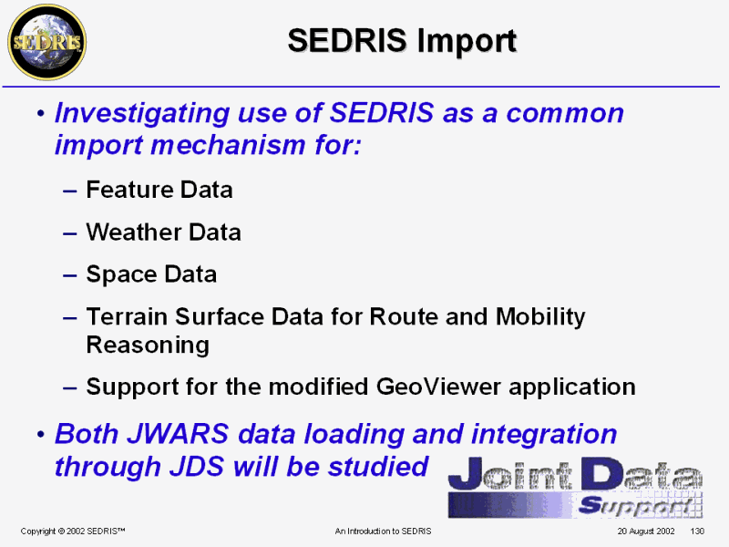 SEDRIS Import |
 SEDRIS in use Today Simulation � Based Acquisition |
 Joint Strike Fighter Generic Composite Scenario Multi-Spectral Data Base |
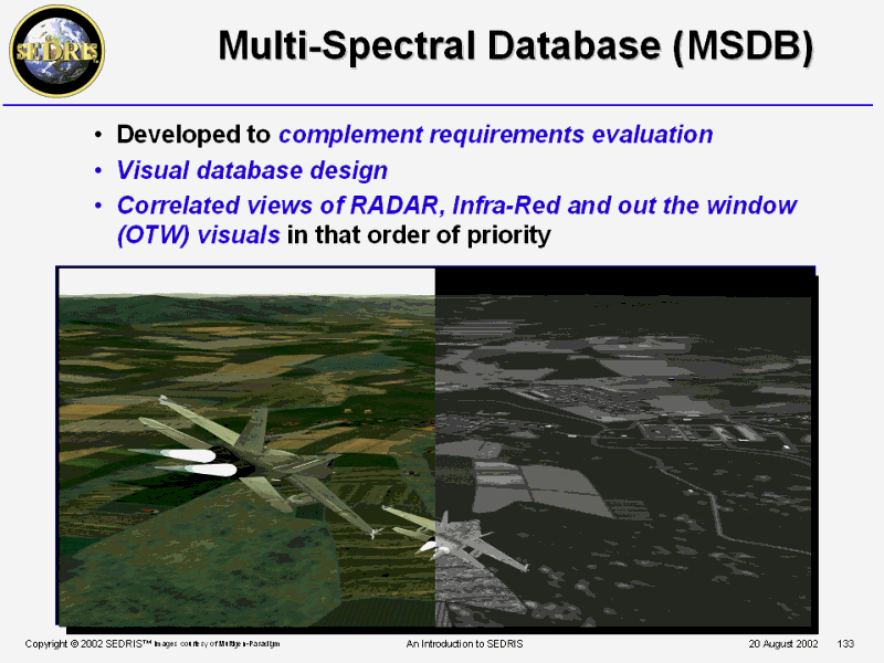 Multi-Spectral Database (MSDB) |
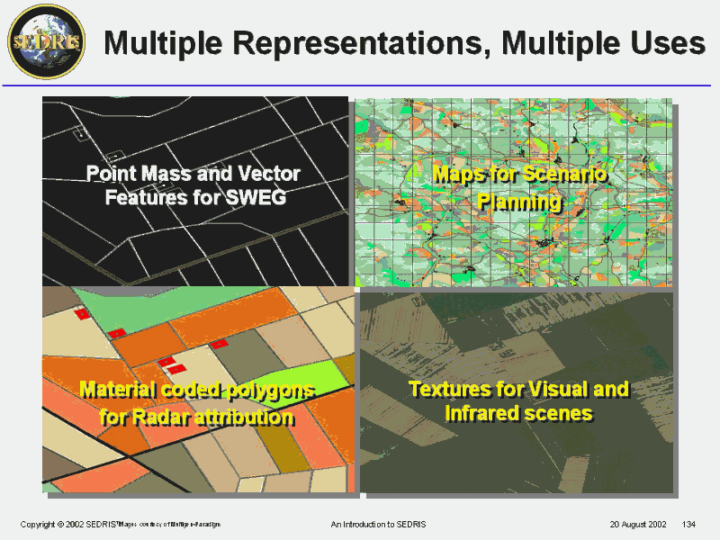 Multiple Representations, Multiple Uses |
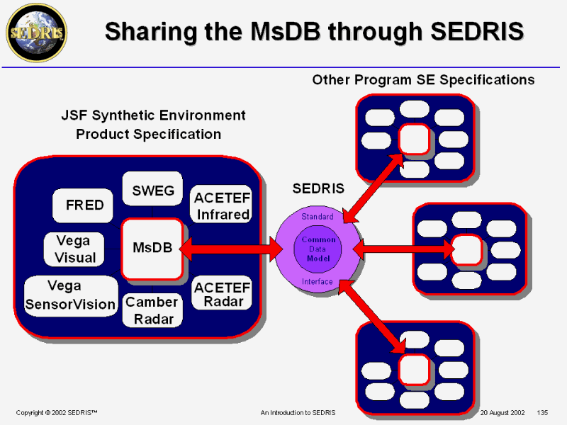 Sharing the MsDB through SEDRIS |
 Joint Modeling and Simulation System |
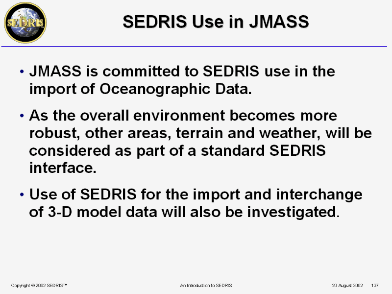 SEDRIS Use in JMASS |
 SEDRIS in use Today Resource Repositories and Production Capabilities |
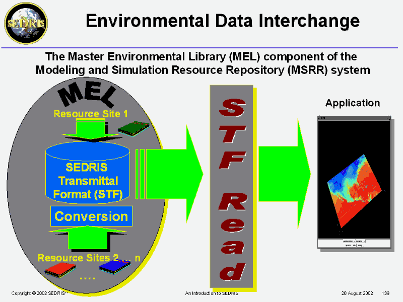 Environmental Data Interchange |
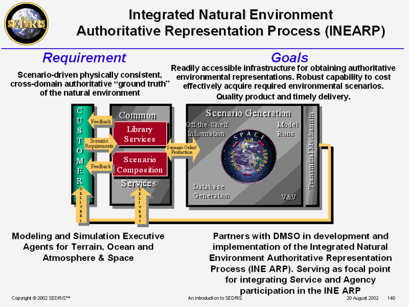 Integrated Natural Environment Authoritative Representation Process (INEARP) |
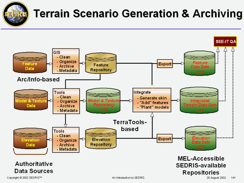 Terrain Scenario Generation & Archiving |
 SEDRIS in use Today Entertainment |
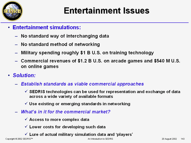 Entertainment Issues |
 Applied Entertainment Technology |
 SEDRIS in use Today more International Applications |
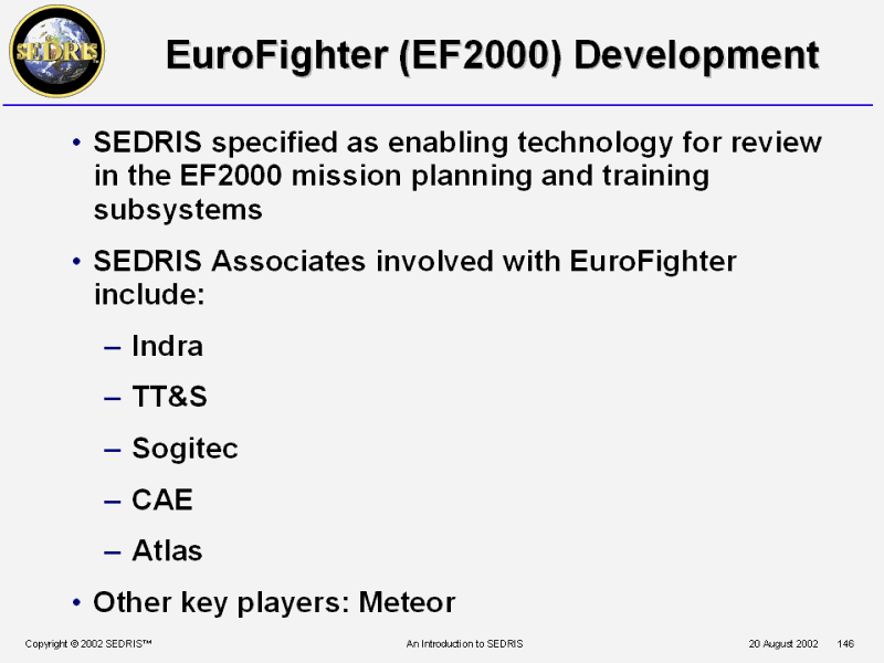 EuroFighter (EF2000) Development |
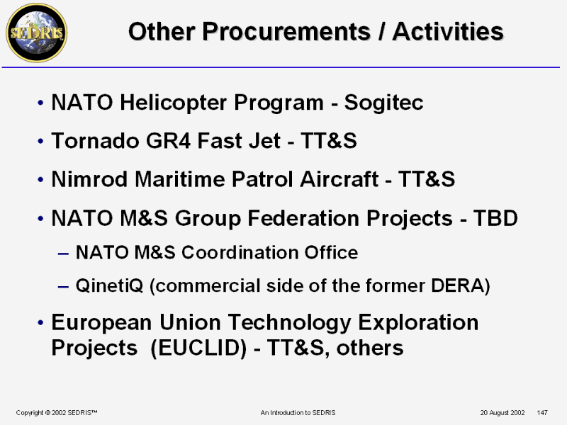 Other Procurements / Activities |
 SEDRIS in use Today Simulation Runtime Applications |
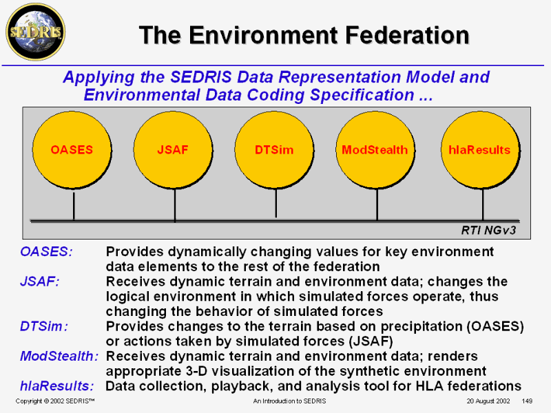 The Environment Federation |
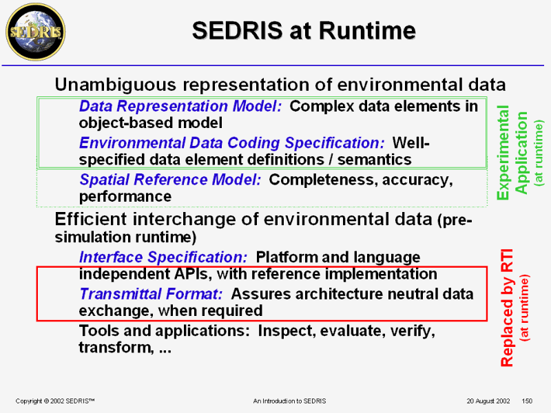 SEDRIS at Runtime |
 PPT Slide |
 Tools and Utilities (Applications) |
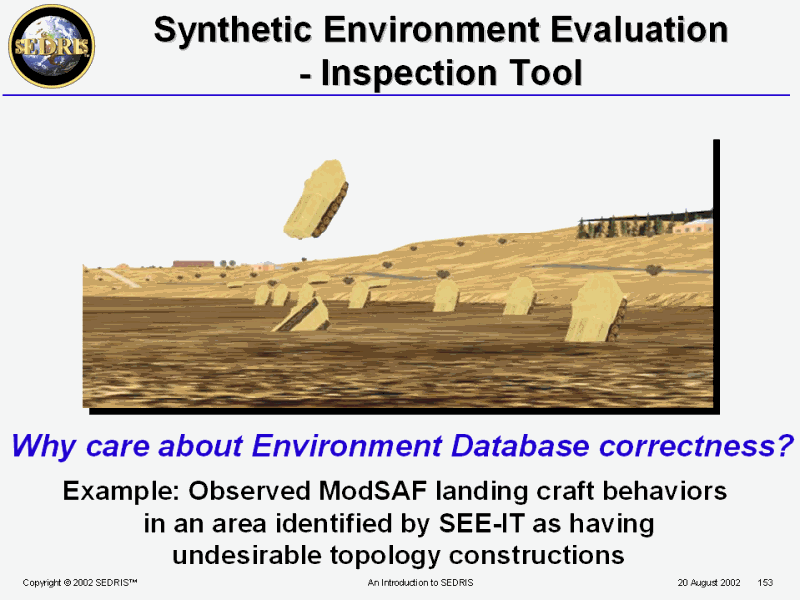 Synthetic Environment Evaluation - Inspection Tool |
 Automated Inspections Must Check? |
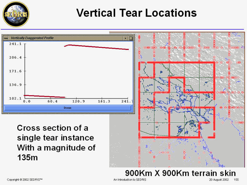 PPT Slide |
 PPT Slide |
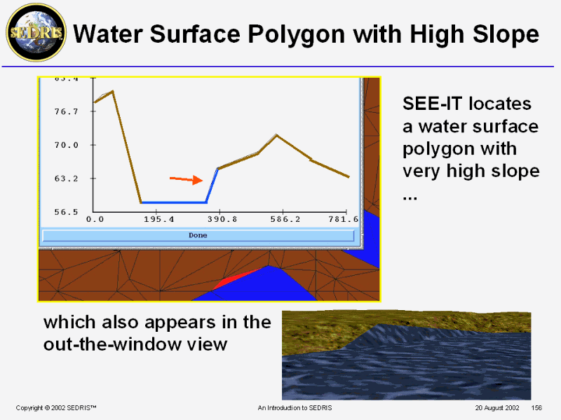
 PPT Slide |
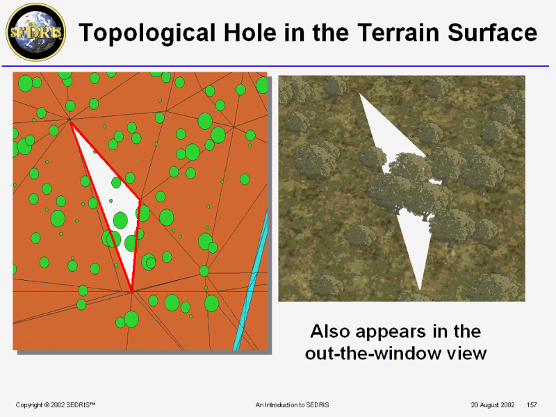
 PPT Slide |
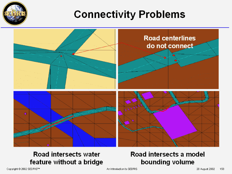
 PPT Slide |
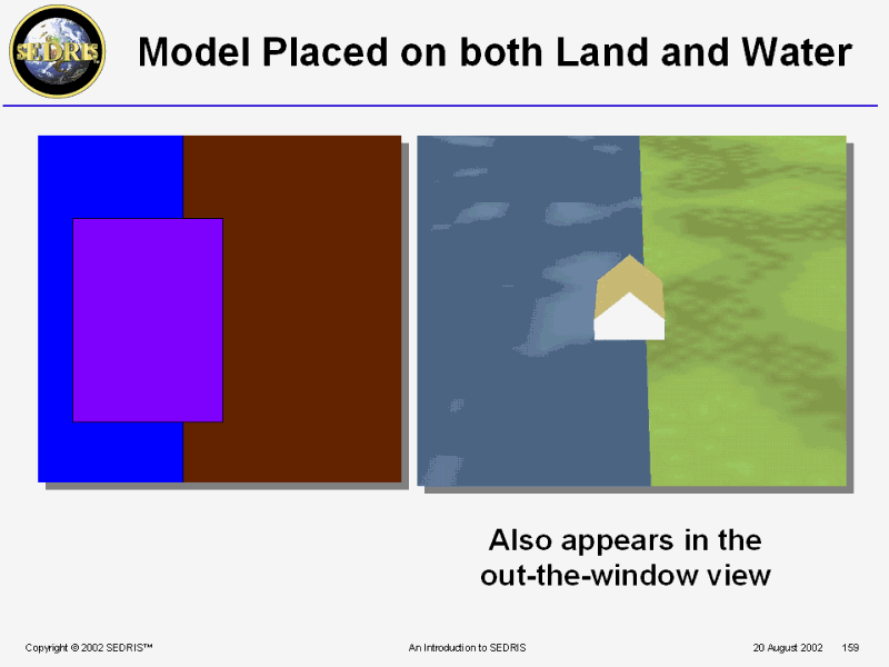
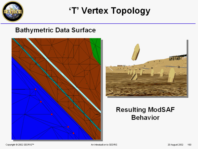 PPT Slide |
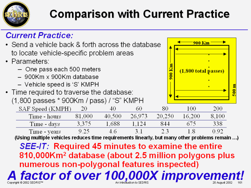 Comparison with Current Practice |
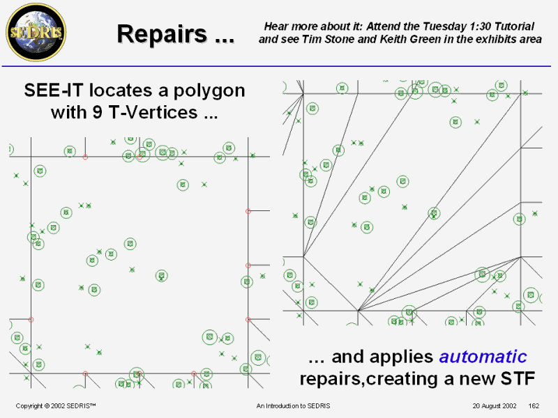 Repairs ... |
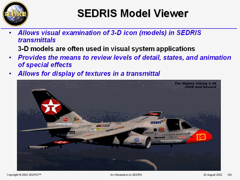 SEDRIS Model Viewer |
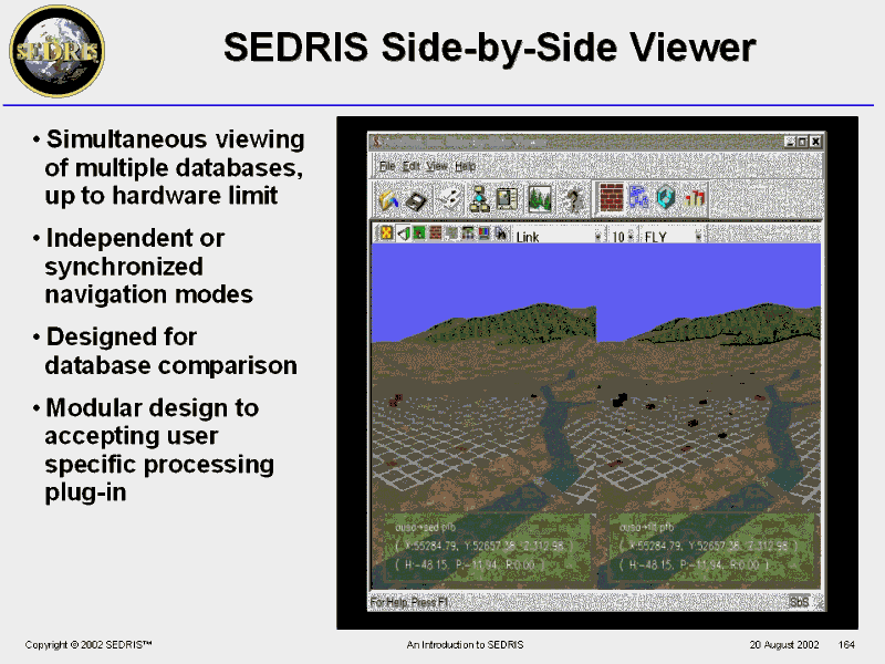 SEDRIS Side-by-Side Viewer |
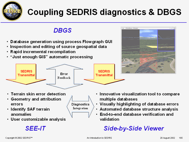 PPT Slide |
 SbS Tutorial |
 SEDRIS Navigator |
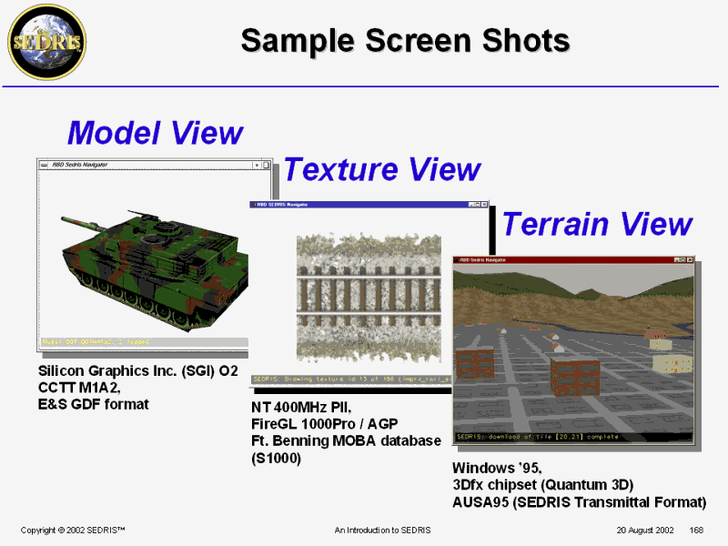 Sample Screen Shots |
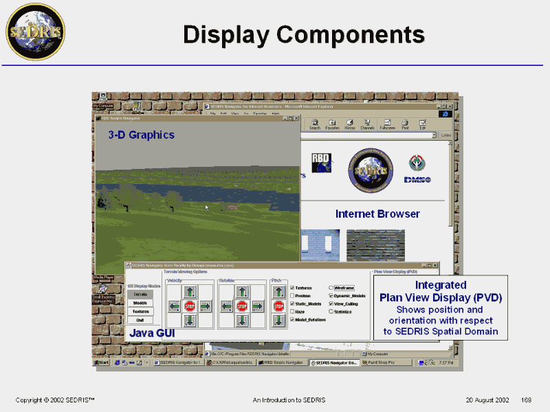 Display Components |
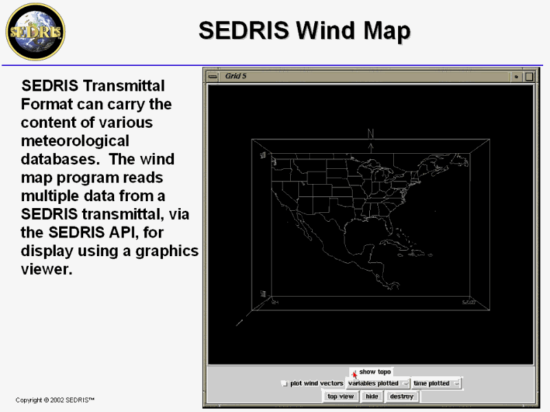 SEDRIS Wind Map |
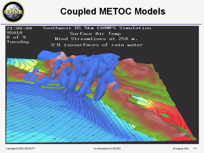 Coupled METOC Models |
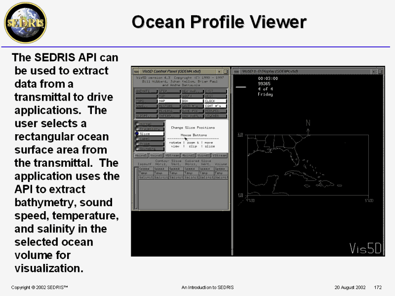 Ocean Profile Viewer |
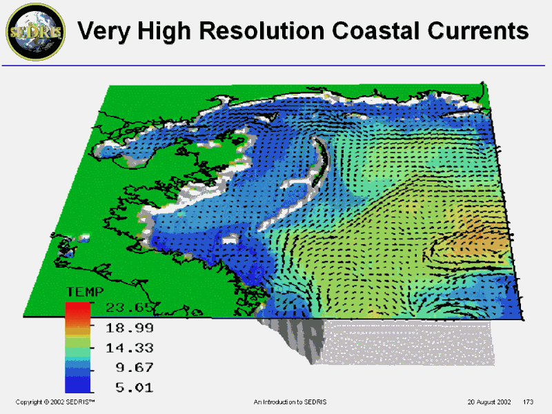 Very High Resolution Coastal Currents |
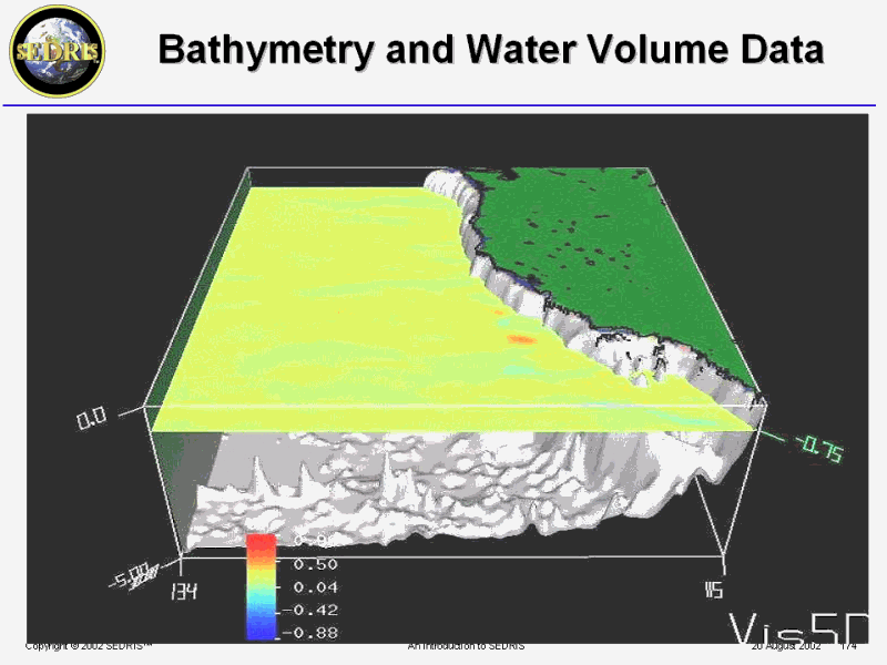 Bathymetry and Water Volume Data |
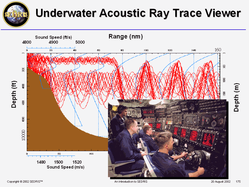 Underwater Acoustic Ray Trace Viewer |
 Highlights and Summary |
 For more information � |
. | . | . |